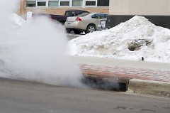
Cleared stormwater catch basin near Jefferson and State Street /John Wiegand

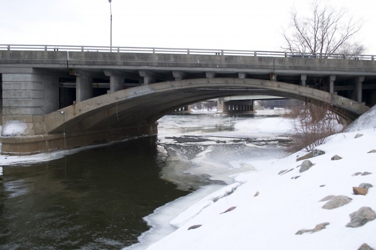
Current Grand River water levels near the Fulton Street bridge /John Wiegand

Cleared stormwater catch basin near Jefferson and State Street /John Wiegand
On April 22, 2013 the Grand River reached a historical height of 21.85 feet due in large part to two significant rain events in the same week, coupled with the typical spring time snowmelt runoff. With this year's heavy snowpack and colder temperatures sticking around into March, some experts are worried that Grand Rapids could see water levels approaching or surpassing last year's flood.
"We looked at the snowpack and we looked at what the runoff would be and just the amount of water contained in the snow alone is pretty substantial," says Peter Wampler, an Associate Professor of Geology at Grand Valley State University who studies human impacts on river systems. "If it all melts off quickly, it will be a lot more water than we've seen for some time."
According to the National Operational Hydrologic Remote Sensing Center, Grand Rapids current 25 inches of snowpack is holding just under five and a half inches of "snow water." This is equivalent to a five and a half inch rain event already sitting on the ground. In comparison, last year at this time the city's snowpack was just over six inches, with a snow water equivalent of nine-tenths of an inch.
The possibility of significant flooding will largely be determined by the rapidity in which the current snowpack melts.
"The perfect situation would be a gradual warm up with cooling at night so we get this gradual ebb and fall of the melt," says Mark Walton, Meteorologist and Hydrologist stationed at the Grand Rapids National Weather Service (NWS) office. "But as we get later through the season with a substantial snowpack, the odds of that happening are less and what ends up happening is we get a major warm up with rain and then we get a lot of runoff all at once. And that is not a good scenario."
Currently, the National Weather Service's Advanced Hydrologic Prediction Service is forecasting a 50 to 90 percent chance that the Grand River will slightly surpass the flood stage of 18 feet by March 25. According to Mike Lunn, Grand Rapids Environmental Services Manager, this is not an uncommon occurrence every couple of years.
"[According to NWS's forecast] there is a good chance that we will get to flood stage, but that is quite a bit less than what it was last year," says Lunn. "So we are going to keep preparing like there could be some elevated water levels. We are not as concerned about a big flood, based on their numbers."
NWS's forecast also expresses a 10 to 50 percent chance that there will be moderate to major flooding of 21 to 23.5 feet between March 11 and March 25.
While this may raise some call for concern, city officials are confident that they are much more prepared for a significant flood event than they were last April.
"We learned a great deal from the experience of last year and we have materials on hand and protocols in place that would be very effective going forward," says Deputy City Manager, Eric DeLong. "We are prepared and we are more prepared than we have ever been to deal with [flood] events that could potentially occur. Teams are meeting and we are doing what we need to do to be at the right stage of readiness."
They are also taking into account the possibility of streets flooding as the snowpack begins to melt. Proactive measures, like ensuring that stormwater catch basins are free from blockage, help to lessen the possibility of rampant standing water on city streets.
"Over the last couple of weeks we have been focusing on neighborhood snow clearing and neighborhood drainage clearing," says DeLong. "Our crews have been out opening up catch basins to help the thaw flow away."
The city is taking a holistic approach to preparing for the snowmelt come warmer temperatures. From talking about the readiness of their equipment and procedures for filling and stacking sandbags to revamping documentation processes, officials are making strides to be as prepared as possible for rising river levels.
"We are looking from the paperwork to the equipment to the supplies. We are looking at all of that and making sure that we have a handle on it," says Lunn.
The Rapidian, a program of the 501(c)3 nonprofit Community Media Center, relies on the community’s support to help cover the cost of training reporters and publishing content.
We need your help.
If each of our readers and content creators who values this community platform help support its creation and maintenance, The Rapidian can continue to educate and facilitate a conversation around issues for years to come.
Please support The Rapidian and make a contribution today.