Underwriting support from:
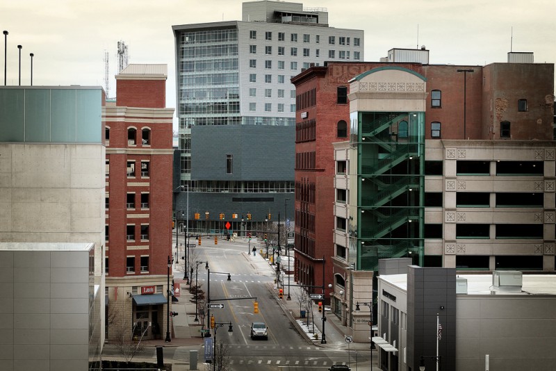
More than most of us realize, the place we live in impacts us. At a visceral level we sense when we love (or don’t) being in certain places in the city but often don’t realize that the physical environment is influencing our very human reactions to it. If we take the time to think about our favorite places in Grand Rapids, what are the characteristics that make us feel safe, excited, peaceful or interested? Why do we find ourselves wanting to return to that space and how can we best create places that are safe and welcoming?
Our internal sense of place is worth paying attention to because with careful planning it is possible to create appealing places. Environments that enhance and enrich our every day living: places with beauty, greenery and art (often in combination) where we shop, work and spend time don’t just happen. They are intentionally created.
Building healthy, functional, productive cities is challenging, but there are tools to do it. One such tool is an overall plan.
In 2002 the City engaged citizens in creating a new vision for the city that resulted in a Master Plan. We were badly in need of an updated plan as the last comprehensive effort had been done in 1963. For years the focus was on managing traffic and architectural showcasing, to the detriment of the people living in the city. Pollution, both air and noise, lack of public space and amenities resulted in unfriendly environments and almost lifeless city centers.
A Master Plan focuses on land use, development and infrastructure: issues on which city policy can have a direct impact. Because times change, plans need to be regularly updated.
The recent foreclosure crisis, for example, resulted in a shift from owner occupied to rental housing, impacting neighborhoods.
The upcoming Silver Line Bus Rapid Transit (BRT) along Division from Kentwood and Wyoming to downtown Grand Rapids will necessitate planning due to its impact on transportation, jobs and the environment.
“Contained within are visions of great neighborhoods, vital business districts, a strong economy, balanced transportation, a city that enriches our lives and is in balance with nature, and partnerships that will help us reach our desired goals," said Robert Zylstra, chair of the City Planning Commission when the Master Plan was completed with extensive community participation. "Grand Rapids will be a community of choice for all people; our businesses will be successful and our streets walkable, bikeable and transit oriented.“
It’s this vision that precedes more precise decisions about specific places. Zoning is more parcel specific and is another important tool to protect and enhance the places in which we live. Zoning seeks to protect public health, safety and welfare by regulating the use of land and controlling the type, size and height of buildings. Two main goals of early zoning codes were to prevent overcrowding and limit incompatible uses. Goals of modern zoning codes include promoting pedestrian-friendly commercial corridors, transit oriented development (BRT for example) and preservation of the historic fabric of neighborhoods.
So, many questions arise when doing thoughtful city planning:
- Are there enough parks and green spaces nearby?
- Is a proposed development going to blend into the neighborhood, take up too much parking space or encourage people to move away?
- What infrastructure is needed to promote economic development, allow shoppers and school children to cross a street safely or promote art, entertainment and play?
- Do we really want another parking ramp or will it use land that could be better utilized for commercial building or green space?
Often further study is needed for specific situations. The Michigan Street Corridor Plan is a great example of this. Experts predicted that without a plan in place the street would become so congested it would drive away future investors, residents and visitors. An 18-month planning process ensued to gather input from residents, neighborhood associations, developers, businesses and the anchor institutions within the corridor. Next steps include exploring the use of Transportation Demand Management to encourage alternative use of transport, shift changes, flexible hours, bike lanes and incentives to address the problem and protect the character of adjacent neighborhoods.
Perhaps the most important planning tool is an engaged and educated citizenry who directly benefit from well-considered and implemented plans. There can be a good deal of debate (ask any neighborhood organizer, I used to be one.) about how to evaluate what the best zoning use is for a particular proposed development.
The trick is to be proactive rather than reactive, which means we must stay engaged. Just as the city is transforming into a learning organization focused on continuous improvement, so must we as its residents stay engaged in order to make sure our public and private space is attractive and well functioning. We can harness these tools to strengthen and enrich our communities or we can neglect them. The choice in this cumbrous, time-consuming democracy is, thankfully, ours to make!
The Rapidian, a program of the 501(c)3 nonprofit Community Media Center, relies on the community’s support to help cover the cost of training reporters and publishing content.
We need your help.
If each of our readers and content creators who values this community platform help support its creation and maintenance, The Rapidian can continue to educate and facilitate a conversation around issues for years to come.
Please support The Rapidian and make a contribution today.